When I first started with all this, my intention was to see if I could figure out a better way to scope out new, undocumented craters, or likely places to go meteorite hunting. I didn’t do so well at first. But ironically, when I quit looking for new craters, and started focusing on identifying formations of airburst melt, I began to find too many new craters to count…
Literally too many to count. And a little bit of everything in between. Even if I had the funding, I could never visit them all. I need help. So over the next few weeks, I am going to post a few new craters a day, in the hope that someone might live close enough, or have interest enough, to go get a closer look. Each place will be presented as is. And with little, or no comments. I may not be able to go there, and do field work. But I can still point, and grunt. You be the judge.
Don’t surprised if you find others nearby any given crater. Few of them fell alone.
Each day when I change craters, I’ll archive previous craters. The archive can be viewed at Daily Craters.
______________________________________________
Nov 15, 2010
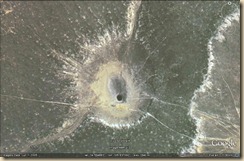 This one is a little different. It’s about 38 miles southeast of Moriarty, NM at 34.594661, -105.637092
 This group is just outside Vaughn NM, at 34.648898, -105.148018
 About 1 1/4 miles south of HWY 247 at 34.133406, -105.098351
______________________________________________
Nov 14, 201o
The best place to hide a tree is a forest. And the best place to hide a multiple fragment, crater field is in karst. A uniformitarian geologist who does not believe in catastrophic, multi-fragment, impact storms won’t even look twice.
 But the 750 meter wide, two rimmed crater at 33.902876, -105.526987 was most certainly not produced by the collapse of a karst cavern.
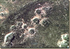 And karst collapses don’t have raised rims either. Like the craters at 33.887450, -105.480889
 Or those at 33.959417, -105.361296
______________________________________________
Nov 9, 2010
 In the Odessa group at 31.617601, -102.271674
______________________________________________
Nov 8, 2010
 This one is about 20 mile west, northwest of Roswell, New Mexico at, 33.499371, -104.853076
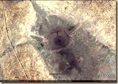 At 33.499061, -104.843313, about 900 meters to the east.
______________________________________________
Nov 7, 2010
 This one’s in the Odessa group about 7 miles northeast of Rankin Texas, at 31.314249, -101.878828
 Also in the Odessa group, 35 miles northeast of Midland, Texas at, 31.602771, -101.683570
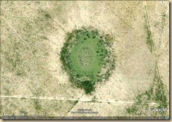 And 38.5 miles south of Midland, Texas at, 31.436845, -102.117032
 This multi-lobed crater is about five miles north of that one at, 31.523146, -102.019700
______________________________________________
Nov 6, 2010
 Here’s another nice one in southern New Mexico at 32.398702, -104.621465
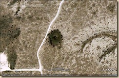 Near there at 32.394320, -104.629412
 They’re part of a group of craters. This one’s at 32.387411, -104.664664
 And here’s a wider view of the group.
______________________________________________
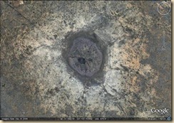
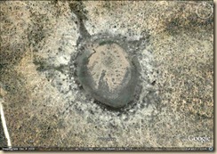
Hi, What a super idea! I’m wondering if you would like for us to re-post this on SOTT.net to reach a wider audience? I think it would be useful to at least put the country and closest city under each photo for quick and easy identification.
Thanks Laura, That would be great! They are all in north central Mexico, West Texas, and New Mexico.
Most of them especially the ones in Mexico are pretty remote. But I’ll put the closest town with each picture.
Hi, great idea. Looking forward to new finds. Check the area around 33.98652,-78.07178 (Brunswick County, North Carolina). There are a number of linear oval features throughout this region called Carolina Bays that were caused by a similar event. Some are ponds, some are areas that weren’t tillable and became overgrown. One of the earliest works was a book by Douglas Johnson entitled “The Origin of the Carolina Bays”
Thanks,
I’m convinced the CBs are a kind of impact structure too.Check out George Howard’s blog, The Cosmic Tusk for all things Carolina Bays though. George has a better handle on the bays than anyone alive.
I’m also pretty sure that we don’t want to find out for sure how they formed. The day they were formed was not a good day.
4 large geoablative melt flow sites west of Carrizozo lava field, New Mexico: Rich Murray 2010.10.30
33.621280 -106.204255 delicate geoablative flow patterns:
to the S is an EW dark lava strip (70 m wide NS)
with long EW flow ridges about 8-17 m apart.
In Google Earth,
use Ctrl down arrow or up to tilt the view,
and Ctrl L arrow or R to rotate,
and the four arrow keys to move horizontally,
making it easy to see the 3D shapes of the land.
Use N to restore the N view.
The area to the N and E has a road Wsmr S Rt 335 (NS) that ends S at Wsmr P Rt 12 (EW),
which becomes CR A003 (EW), which goes E across
the thin middle of Carrizozo lava field
and then crosses US 54 (NNE).
Wspr P Rt 9 (NS) is 74 m lower to the W.
33.709143 -106.145081 classic vertical geoablation ridges
33.654083 -106.041597 1.692 km el peak
within huge geoablative melt air blast area
33.760188 -106.197151 2.061 km el peak
geoablation melt
Airbursts were only part of it. You are looking in the middle of one of the best kept secrets in the Earth Sciences. The contrast in color between the black lava flow, and the geo-ablative melt that’s been labeled as volcanic tuff is pretty stark.
But while you’re looking at the terrains in that part of the country why not zoom in close, and show them a few craters. Look a few miles north to 34.211413, -105.970368
Or, in the same way the best place to hide a tree is in a forest, the best place to hide a large, multiple fragment, crater field is in Karst. You can confuse things a little more, if you have a few bombing ranges in the area. An old school geologist who can’t conceive of a multiple fragment impact storm, won’t even look twice.
But look in the Karst geology about 45 miles to the east of there at 33.902835, -105.527273. If that’s a sinkhole, at 750 meters diameter, it’s a monster. And since when do karst collapses make two bowl craters?
Look closely just the east of there, those aren’t sink holes folks. And they’re not bomb craters either. The two bowl craters like those are predicted in E.M. Drobyshevski’s work on the explosive cosmogony of comets.
And large cluster events are a part of the postulate if the Taurid complex had anything to do with it.
Dennis; I was rereading your patterned peats post and at the end of your posting you mentioned going out the west Texas New Mexico area to study the “sink Holes” out there. I was wondering if there qwas any pattern to the depressions that would indicate direction of impact also any idea of approx dates for these craters. I’m presently kicking around another wild hair and this info would be beneficial to making or breaking my idea. As always thanks for your time